


Promoted
Jev AI Model
freemiumJev AI Model pairs a free playground with an API for turning text or JSON state into typed classifications, scores, and yes/no probability outputs.
AIDeveloper ToolAnalytics
What it does, who it helps, and how it fits into your workflow.
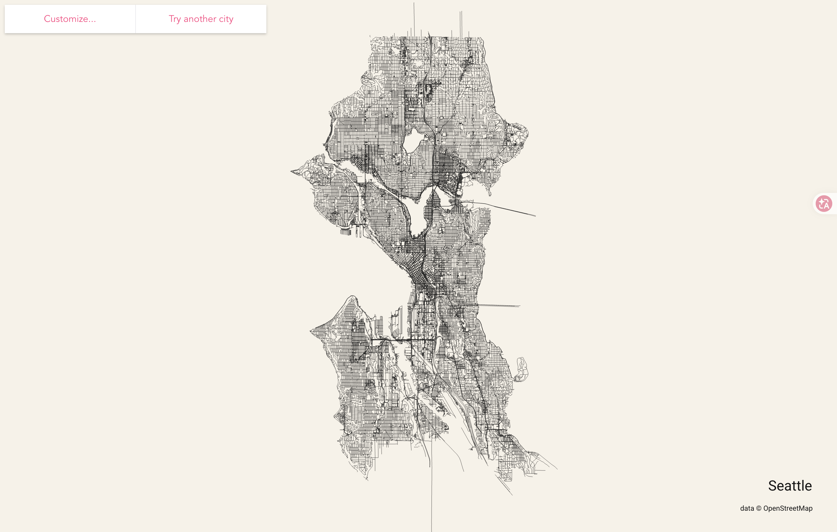
City Roads is a browser-based map visualization: enter a city, select a matching area, and render its road network as a single graphic. The homepage describes the result as rendering every road within a city. In a hands-on check on October 1, 2026, the workflow produced a Seattle road map with the city name and an OpenStreetMap data credit. The page is best understood as a way to look at street patterns, rather than a conventional map for finding places or getting directions.
The product is deliberately focused. Instead of starting with route planning or place search, it turns a selected city boundary into a dense visual network that can be explored as an image-like composition.
The Seattle flow completed during this review. Large cities may be resource-intensive: the interface warns that they can require 200MB+ of data transfer and a powerful device to render. Start with a smaller area if the browser stalls, and avoid treating a long wait as proof that the selected boundary is wrong.
City Roads is a fit for designers, cartography enthusiasts, visual storytellers, and creators who want to inspect a city’s street structure as a whole. A rendered network can help inspire a poster, an editorial graphic, or an urban-form discussion. Those are creative applications, not built-in publishing features: the review did not verify export formats, commercial reuse permissions, or a dedicated print workflow.
It is less suitable when the task is finding a business, choosing a route, checking live traffic, or navigating turn by turn. Those are different map jobs. The value here is the visual pattern of a selected city, rather than operational guidance for a trip.
The Seattle core workflow was completed without an account, trial, or payment on October 1, 2026. For that reason, this listing is marked free based on observed use. The checked interface did not show a public pricing table or a schedule of paid tiers, so this should not be read as a guarantee that every use, future feature, or data request will always be free.
Before relying on the service for a production project, revisit the official page for current access conditions and consider the data-transfer warning for larger places.
Strengths
Limitations
Choose City Roads when the desired result is a visual overview of a city’s street pattern. Choose a conventional map when you need to locate places or navigate. For broader map-data browsing, OpenStreetMap provides map data for websites, apps, and devices, and its About page describes its community-maintained road and place data. These products serve different needs: City Roads creates a focused road-network rendering, while OpenStreetMap is a general map-data project.
OpenStreetMap states that its data is open for use with attribution, with additional licensing conditions applying in some cases. Check its current copyright and licence guidance before reusing data or screenshots.
It renders a selected city’s road network as a visual map-like composition. The observed Seattle result included an OpenStreetMap credit.
The Seattle generation flow tested for this review completed without sign-in, a trial, or payment. No public pricing schedule was shown, so current access should be checked on the official site.
Search for a city, select the matching area suggestion, and choose Download Area. Wait for the page to render the result.
The page warns that large cities can require 200MB+ of data transfer and a powerful device. Network speed, browser resources, and the size of the selected boundary can affect the experience.
No navigation workflow was observed. Treat it as a road-network visualization, not as directions or live route guidance.
The output displayed OpenStreetMap attribution, but this review did not verify City Roads-specific export or commercial-use terms. Check the current product page and applicable OpenStreetMap attribution and licensing guidance before publishing.
Last checked: 2026-10-01.
Verification: Opened the City Roads page, searched for Seattle, selected the suggested administrative boundary, started Download Area, and inspected the completed map controls, city label, and attribution. Checked the large-city warning. Reviewed OpenStreetMap’s About page for the alternative-use context. Only the Seattle flow and visible controls described above were verified; no pricing table, export formats, commercial-use workflow, or other cities were confirmed.
Jev AI Model pairs a free playground with an API for turning text or JSON state into typed classifications, scores, and yes/no probability outputs.
Best Jev AI pairs a free playground with an OpenRouter gateway for turning text or JSON context into typed choices, scores, and yes/no probabilities.

Browse Rush Ounza’s public software-engineering portfolio, including machine-learning notebooks, web projects, activities, and background.